Geography of Bhutan
Bhutan is a small, landlocked kingdom located in the Eastern Himalayas, bordered by China to the north and India to the south, east, and west. Despite its small size, Bhutan’s geography is highly diverse, with its dramatic landscapes ranging from subtropical plains in the south to the towering peaks of the Himalayas in the north.
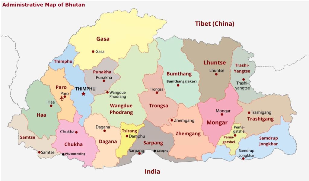
Location and Borders
- Country Size: Bhutan covers an area of approximately 38,394 square kilometers (14,824 square miles).
- Borders: Bhutan shares its northern border with China (Tibet) and its southern, eastern, and western borders with India. It is situated between two major giants—China to the north and India to the south—which greatly influences its political, economic, and cultural landscape.
Topography
Bhutan is known for its steep and rugged terrain, which varies significantly across the country. It is often divided into three distinct geographical regions:
- Southern Region (Duars)
- The southern part of Bhutan is characterized by subtropical plains and foothills. This area, known as the Duars, lies at a low altitude of around 300 to 1,500 meters above sea level. The region is heavily forested, with tropical vegetation and rivers flowing from the northern highlands.
- Climate: The climate in the south is warm and humid, with monsoon rains during the summer months, making it suitable for agriculture like rice, maize, and citrus fruits.
- Notable Areas: The southern towns like Phuentsholing and Samdrup Jongkhar are located here, serving as trade and economic hubs.
- Central Region (Inner Himalayas)
- The central region is more temperate and is the heart of Bhutan. This area is situated at an elevation of 1,500 to 3,500 meters and includes valleys and mid-sized mountains.
- The region features forests, alpine meadows, and numerous rivers and streams. The central valleys of Bumthang, Punakha, and Wangdue Phodrang are famous for their scenic beauty, fertile land, and religious significance.
- Climate: The climate in this region is mild, with warm summers and cold winters, and supports agricultural activities like barley and wheat farming, as well as the growing of medicinal herbs.
- Notable Areas: The city of Thimphu, the capital, and Paro, which is home to the iconic Tiger’s Nest Monastery, are located in the central region.
- Northern Region (High Himalayas)
- The northernmost region of Bhutan is dominated by the high Himalayan mountains, with peaks reaching above 7,000 meters. The highest point in Bhutan is Gangkhar Puensum, standing at 7,570 meters, which is considered the highest unclimbed peak in the world.
- This area is sparsely populated due to the extreme altitude, harsh climate, and rugged terrain. Glaciers, alpine meadows, and rivers that originate from these mountains flow down through the valleys below.
- Climate: The climate is cold and snowy, with long, harsh winters and brief summers. Snowfall is common, especially in the higher regions, making this area inhospitable for large-scale human settlements.
- Notable Areas: The Jigme Dorji National Park and the protected area around the Gangkhar Puensum are located in this region.
Rivers and Water Bodies
Bhutan is a land of rivers that drain from the Himalayas, and these rivers play a crucial role in shaping the landscape. Most of the rivers in Bhutan are tributaries of the Brahmaputra River in India.
- The Drangme Chhu is the longest river in Bhutan, running from the east to the south, forming part of the border with India.
- The Wang Chhu, which flows through the capital Thimphu, is another important river that flows from the northern mountains to the southern plains.
- The Punakha Chhu and Mo Chhu rivers are significant in the Punakha Valley and are essential for irrigation and agriculture.
Climate Zones
Bhutan’s climate varies significantly due to the varied altitudes and geography:
- Subtropical Climate (South Bhutan): Hot, humid, and monsoon-dominated, with heavy rainfall from June to September.
- Temperate Climate (Central Bhutan): Moderate temperatures with warm summers and cold winters.
- Alpine Climate (North Bhutan): Cold, snowy winters, with cool summers, at high altitudes above 3,500 meters.
Natural Features and Landforms
- Mountain Ranges: The country’s northern region is dominated by the Himalayan mountain range, which is home to some of the world’s highest peaks. These mountains are key to Bhutan’s water systems and create a natural barrier that isolates Bhutan from its neighbors.
- Valleys and Terraces: Bhutan’s valleys, particularly in the central and western regions, are the result of erosion caused by the rivers cutting through the mountains. These fertile valleys are home to the majority of Bhutan’s population.
- Jigme Dorji National Park and Royal Manas National Park are some of the country’s important protected areas, preserving both the flora and fauna and the country’s mountainous landscapes.
Conclusion
Bhutan’s geography is marked by dramatic contrasts, from lush subtropical forests in the south to snow-capped peaks in the north. Its natural features have shaped not only its climate and agriculture but also its culture and way of life. The mountainous terrain has preserved Bhutan’s cultural heritage, and the natural beauty of the land plays a key role in the country’s identity and the philosophy of Gross National Happiness (GNH). The landlocked nature of Bhutan, combined with its rugged terrain and environmental conservation, makes it one of the most pristine and ecologically protected countries in the world.